
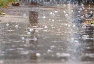
 Updated: June 27, 2:40 p.m. The National Weather Service has issued a Flash Flood Warning for the area as roads will become inundated and small streams will overflow their banks. Original Story: The severe weather continues to plague the area at least through Saturday. The National Weather Service has issued a Flash Flood Watch from late tonight to Saturday night. "Low pressure is expected to intensify over the Ohio Valley tonight and move into southwestern New York by Sunday morning," NWS said "As it does so.a warm front will lift through southern and central Virginia Saturday and Saturday night with heavy rains developing late tonight into Saturday morning across the Shenandoah Valley and spreading northeast across the rest of the area Saturday morning." Residents will see heavy rain and thunderstorms into Saturday evening, with one to three inches of ran by the time the cold front leaves late Saturday night. "Given the very wet antecedent conditions and heavy rains expected on Saturday, potential exists for flash flooding to occur on small streams, creeks and urban areas," one forecaster said. "Significant rises are also likely on main stem rivers such as the Potomac and Shenandoah Rivers." NWS also warns of a slight risk of severe thunderstorms Saturday afternoon and evening, which may include damaging winds and isolated tornadoes.


Support Bristow Beat - Donate Today!