
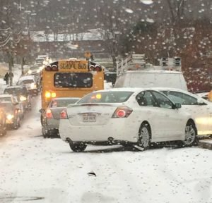
 The National Weather Service has issued a Winter Weather Advisory from 7 p.m. Sunday to 10 a.m. Monday. NWS forecasts snow, sleet and freezing rain with total snow accumulations of up to one inch and ice accumulations of less than a tenth of an inch. A Winter Weather Advisory means that periods of snow, sleet or freezing rain will cause travel difficulties. NWS warns of slippery roads and limited visibilities. While the advisory is scheduled to end at 10 a.m., NWS could extend it as temperatures struggle to rise above freezing. "On Monday, the first wave pushes east and there may be a lull in precipitation, most likely later in the morning into the mid afternoon," a forecaster said. "Guidance allows surface temps to warm up during this time, as well; thus, [we will] cut the advisory at 10 a.m. for now, though its certainly possible it may need to be extended later for parts of the region." According to NWS, there is a threat for wintry precipitation again later Monday into Tuesday.
 "Some areas which rise above freezing during the day Monday may drop back below freezing Monday night before a final rise above freezing Tuesday," they said.
Bristow Beat will continue to monitor the weather event.


Support Bristow Beat - Donate Today!