
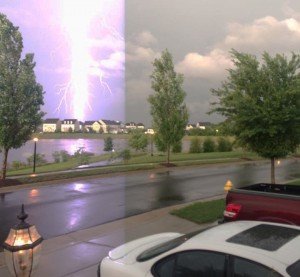
 Jason Thacker submitted this photo of a lightning strike, taken near Linton Hall Road Saturday evening.
The area could see severe weather Thursday night and conditions could be favorable for another tornado.
The National Weather Service forecasts a slight risk of severe thundershowers this afternoon into tonight, which could include damaging winds, large hail, and isolated tornadoes.
"Wind fields will strengthen today and by tonight look favorable for strong to severe thunderstorms producing damaging winds and large hail," an NWS forecaster said Thursday morning. "A southeast component to the surface wind this evening produce a tornado, mainly east of the Blue Ridge."
The weather service calls for showers and possibly a thunderstorm before 2 a.m, then a chance of showers and thunderstorms, possibly severe, through 8 a.m. Friday. The chance of precipitation is 60 percent and new rainfall amounts between a quarter and half of an inch are possible.
"If sags southward and northerly winds bring in drier air, areas near the DC Metro area may see localized flooding," they said.
Showers and thunderstorms are expected to develop Saturday and Saturday night.
Bristow Beat will continue to provide updates.


Support Bristow Beat - Donate Today!