
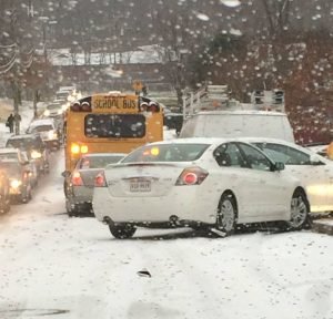
 Updated: Feb. 19, 7 a.m. The National Weather Service has upgraded the Winter Storm Watch to A Winter Storm Warning from 1 a.m. until 7 p.m. February 20. NWS expects heavy mixed precipitation with total snow accumulations of 4 to 6 inches and ice accumulations of up to one tenth. "Travel could be very difficult. The hazardous conditions could impact the morning or evening commute," they said. Original Story: The National Weather Service has issued a Winter Storm Watch from Feb. 19, 10 p.m. until February 20 at 10 p.m. NWS forecasts heavy snow, mixing with and eventually changing to sleet and then freezing rain; snow accumulations of five or more inches and ice accumulations of a quarter-inch or greater are possible. A Winter Storm Watch means there is potential for significant snow, sleet or ice accumulations that may impact travel. NWS warns that the initial precipitation that results will be anything but weak, resulting in a swath of moderate to heavy precipitation. "We believe that precipitation (snow) will develop Tuesday night from southwest to northeast," he said. "The warm will permit a warm nose to develop, causing the precipitation to gradually change from snow to sleet, freezing rain, and ultimately rain." This transition likely will not start until midday Wednesday. There is the potential for a significant snowfall prior to the changeover.
 On Thursday morning, low pressure will push off to the north and east with lingering light rain across the area.
Temperatures on Thursday will warm into the upper 40s across our northern tier, with 50s generally everywhere else," he said. "This will certainly help melt the recently fallen snow/ice, which may result in some flooding concerns of smaller streams/creeks."
Bristow Beat will continue to monitor the weather event.


Support Bristow Beat - Donate Today!